Itoigawa-Shizuoka Tectonic Line and Salt Trail (North) Area
An Ancient Trail Along a Gigantic Fault
The Itoigawa-Shizuoka Tectonic Line, which separates Japan into eastern and western halves, runs along the western border of Fossa Magna. The fault line mostly follows the path of the Himekawa River, but between Negoya and Kitaotari it runs along the mountains just east of the river. The area along this fault produced many landslides and topographical basins, resulting in the area's gentle slope seen today. It was by connecting these basins and gentle-sloping areas that the Salt Trail was created. Construction of the road was not without peril, though, as the Himekawa River often floods and landslides are fairly common.
Along this road, various goods from the sea were transported from Niigata to Nagano and exchanged for products like tobacco and cereal grains. One area along the road is known by the name of 'Utou.' The slope here is not natural; rather, it was excavated by the early roadworkers to permit easier travel. In addition to the ruins of old teahouses and guideposts, one can find the remains of an old trade road here.
At nearby Fossa Magna Park, one can observe the Itoigawa-Shizuoka Tectonic Line, outcrops, and pillow lava as well as learn about the formation of Fossa Magna.
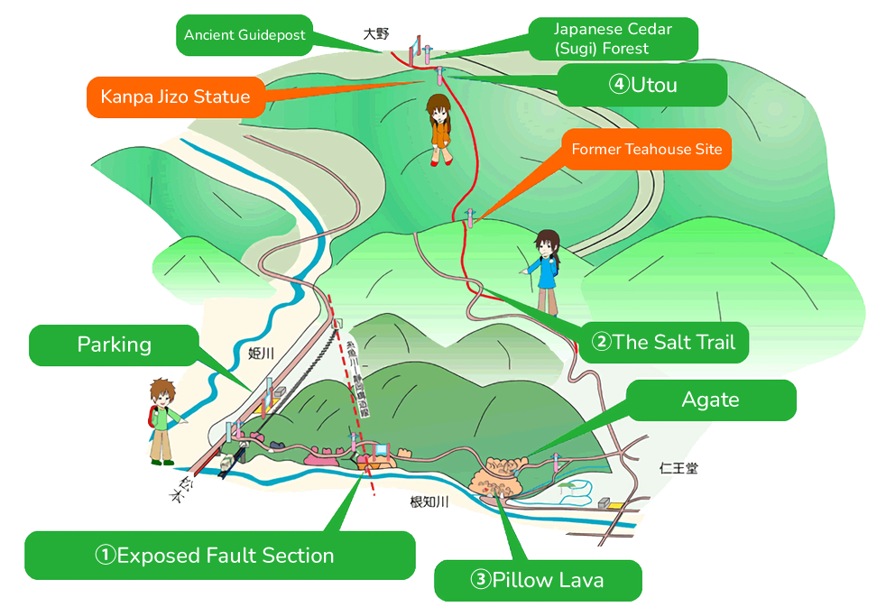
1Exposed Fault Section
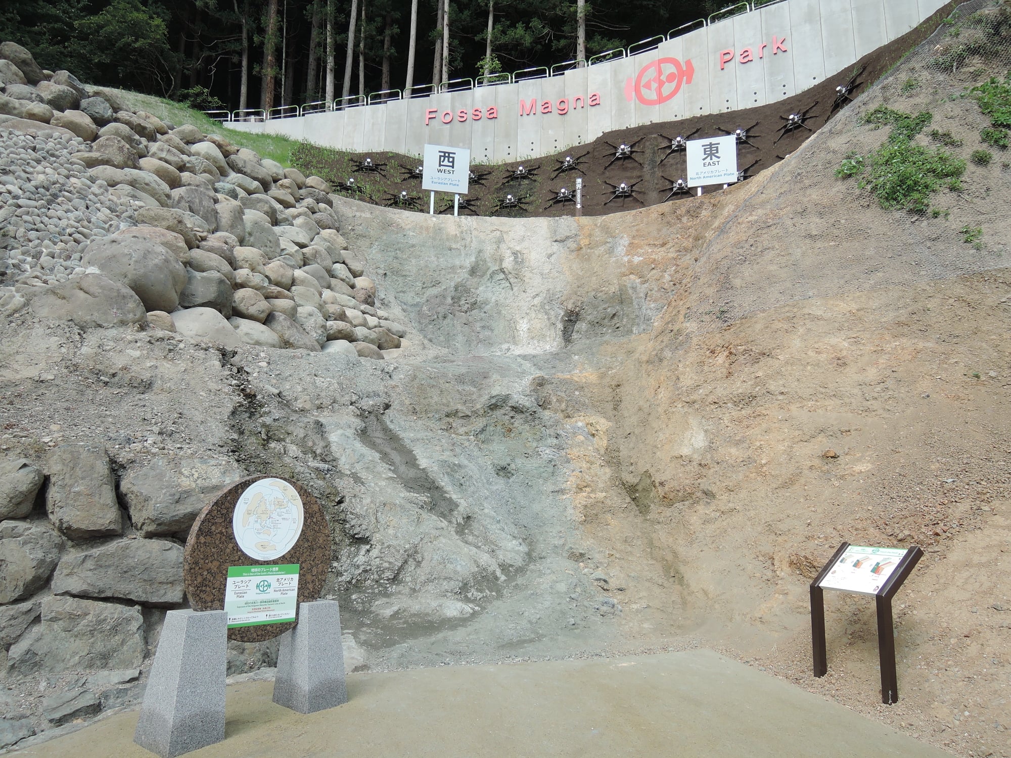
ISTL EXposed Fault
Newly renovated in 2018, Fossa Magna Park is centered on an exposed section of the Itoigawa-Shizuoka Tectonic Line, a massive fault which splits Japan in two, forming the western boundary of the Fossa Magna. The rocks on the east (right) side of the fault are 16 million years old, while those the west (left) side of the fault are over 400 million years old!
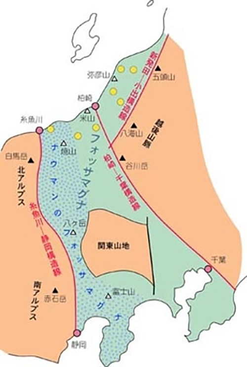
Fossa Magna
Discovered and named by German geologist Edmund Naumann in the late 19th century, the Fossa Magna or “Great Ditch,” is a massive geological trench which runs through the center of Japan. It formed 20 million years ago as Japan broke apart from the Asian continent and features much newer geology than the surrounding regions.
2The Salt Trail (Matsumoto Highway)
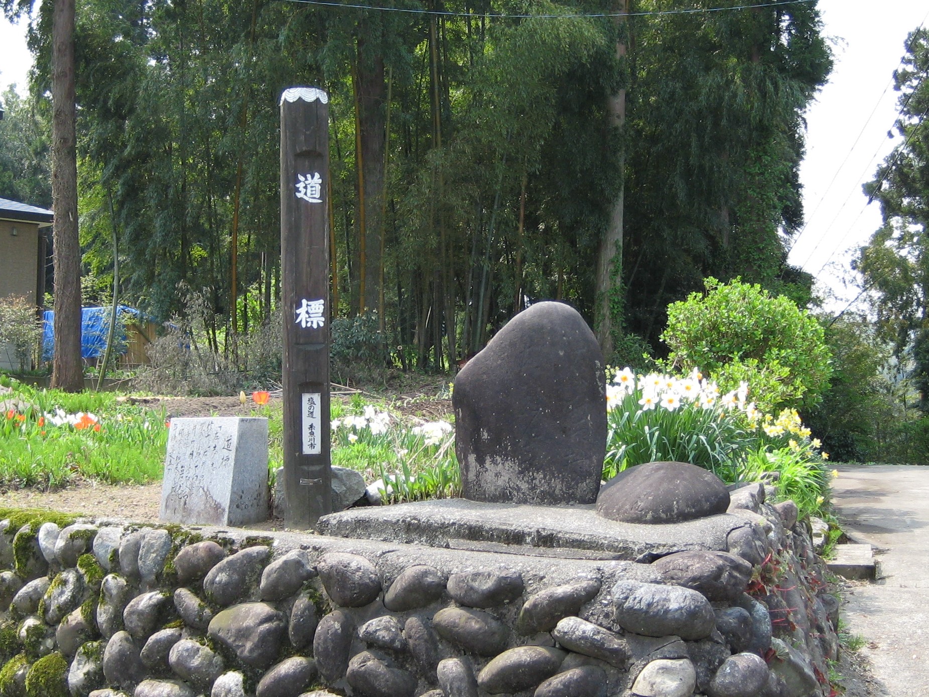
Guidepost of The Salt Trail
The gentle terrain along the fault has been used as a road since ancient times to avoid the dangerous Himekawa River below. The Matsumoto Road, also called the Salt Trail, was a vital link between the Sea of Japan and the inland provinces. Many old guideposts, statues, and other remnants can still be seen today.
3Pillow Lava
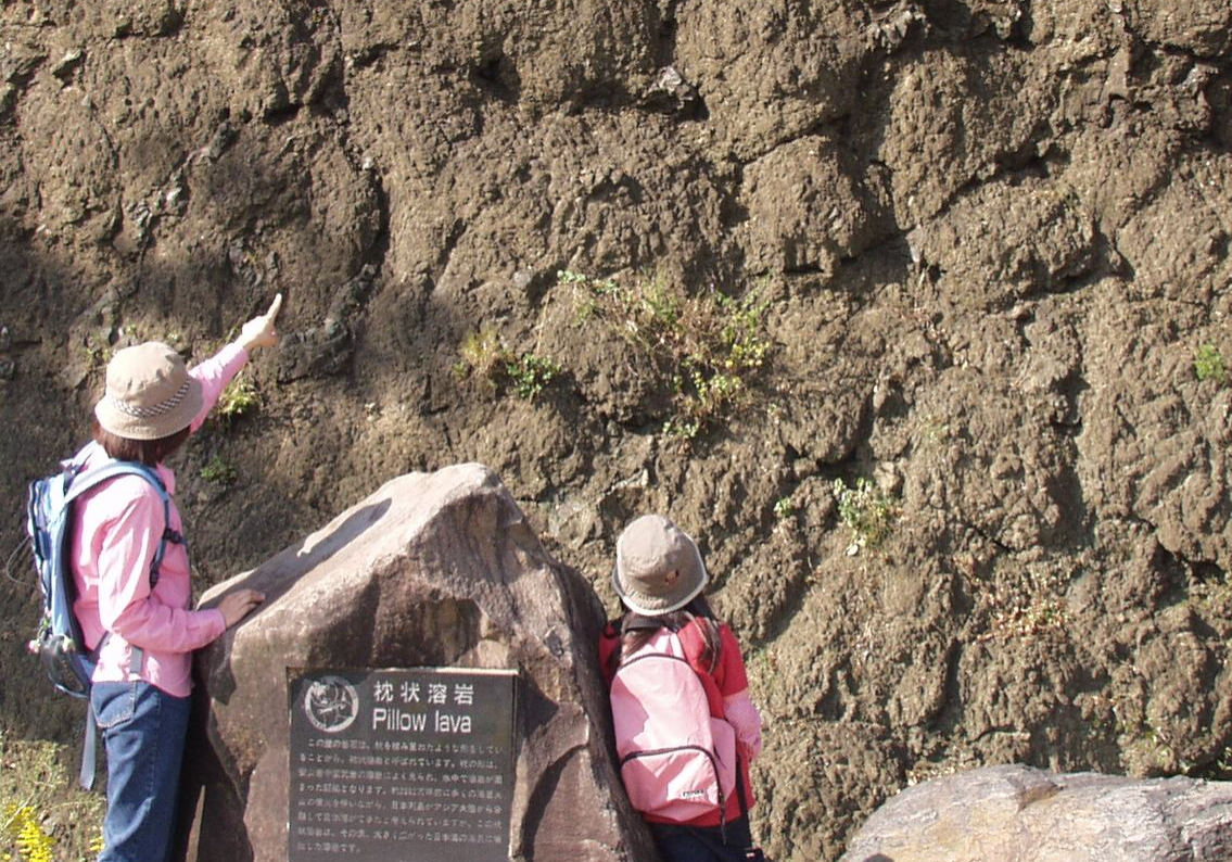
Pillow Lava Exposed by the Nechigawa River
Pillow lava is formed when lava erupts from an underwater volcano in a tube-like shape. These tubes of lava pile up, looking like a stack of pillows. Along with the mollusc fossils found in the strata above, this pillow lava provides proof that this area was once at the bottom of the sea.
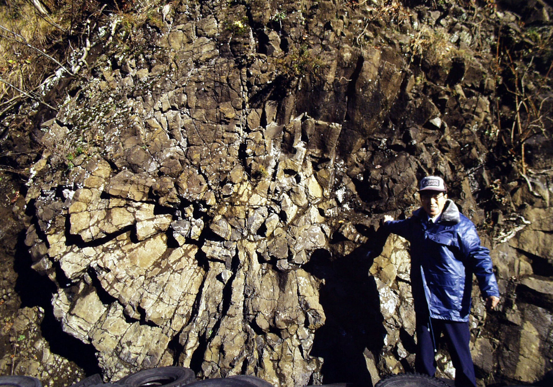
Wheel Stone(Japan’s Largest Pillow Lava)
Along the walkway in Fossa Magna Park, you can see a massive wheel-shaped rock formation. This is actually a large, single pillow lava tube and is among the largest such formations in Japan.
4Utou
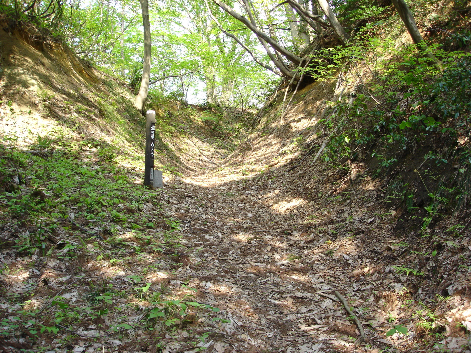
The Salt Trail Utou
Utou is the local name given to the U-shaped paths excavated through the mountains along The Salt Trail. The Utou in the Ono area is particularly well-preserved and is a famous spot along the Salt Trail popular with hikers.
5Kanpa Jizo Statue

Kanpa is a local word for a skin disease once common among children. People living along the Salt Trail would bring their children to this statue to pray for protection and healing miracles.
Area Access & Closures
No Alerts


