Umidani Gorge Area
Scenic Highlands and Large Cross Section of Submarine Volcano
Umidani Gorge, rather unassuming in its appearance, was created when a volcano was bisected by a river. This volcano formed over 3 million years ago, when the Fossa Magna region was submerged under the sea. The resulting cliff walls beautifully preserve the internal features of this former volcano, including volcanic ash and lava flows. From the viewing platform, you can see a strangely-shaped rock called "Zenmai Jizo" for its resemblance to the zenmai mountain vegetable as well as that to a jizo Buddhist statue. This rock formation is said to watch over and protect those who travel through this gorge.
In the upstream region of the Umikawa River, there are absolutely no erosion control structures in place, leaving this as one of the few examples in Japan of a river valley in its natural state. Umidani Highland, a large dried river bed, was formed when a large landslide in 1597 dammed the river, creating a temporary lake. With colors that change from light green in spring to deep green in summer and beautiful reds in autumn, this gorge is a hiker's paradise.

1Umidani Highland
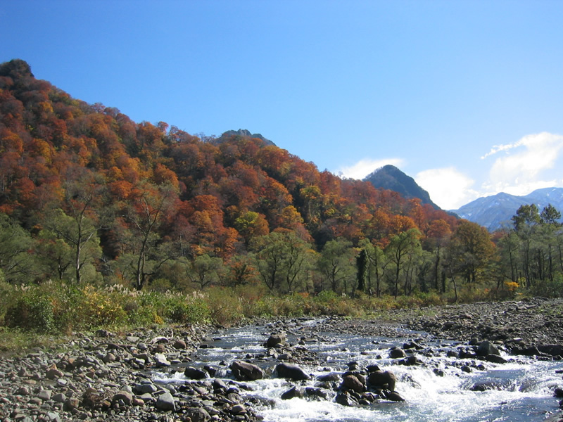
The wide, flat expanse known as Umidani Highland was formed when a landslide blocked the river, forming a large lake. The natural dam eventually collapsed and the lake emptied, leaving an idyllic landscape often called the “Kamikōchi of Echigo” in comparison to Nagano’s famous Kamikōchi, which formed in a similar way.
2Umidani Sankyo Park
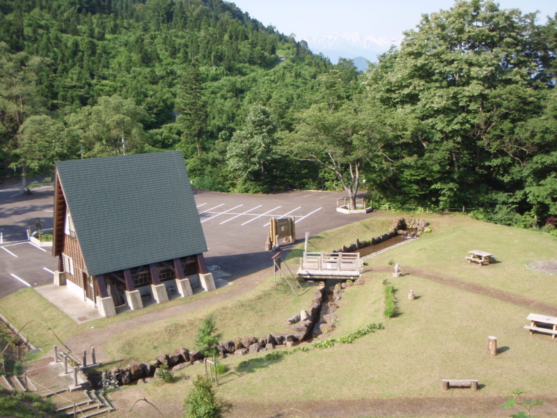
This park is the basecamp for hiking Umidani Highland and the surrounding mountains. The park features campsites, fire pits, and a recreational field. The nearby viewing deck affords an outstanding view of the rock face of Mt. Senjōgatake.
3Cliff of Mt. Senjōgatake
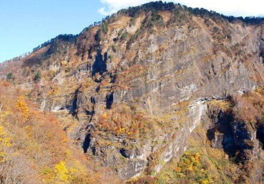
This massive wall-like cliff located across the gorge from the observation deck is inner face of Mt. Senjōgatake. If you look carefully at the rock face, you will see a number of diagonal stripes along its surface. The stripes were formed over the ages by layers of lava and ash flowing from the submarine volcano that formed this mountain. Repeated eruption cycles caused these lava and ash layers to stack to 1600m in height. The volcano was then pushed above the sea and split into two by the Umikawa River, forming the impressive rock cliff visible today.
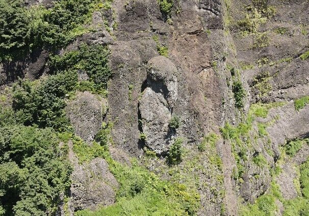
Zenmai Jizō
A curious rock shaped like a zenmai (edible fern) sits halfway up the cliff. Locals have named it “Zenmai Jizō” and it is said to watch in guard over visitors to the gorge.
4Mt. Hachiyama(1,575 m)
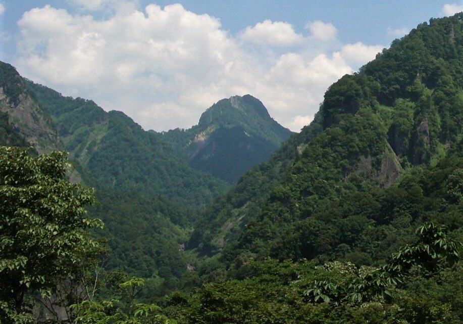
Mt. Hachiyama, or “Bowl Mountain,” gets its name from its peak, which resembles an overturned bowl. It was once a conduit where magma flowed. This magma cooled underground into porphyrite, which forms the mountain today.
5Mt. Komagatake(1,487 m)
Warning: file_get_contents(https://geo-itoigawa.com/wp-content/uploads/2023/12/駒ヶ岳空撮01.jpg): Failed to open stream: HTTP request failed! HTTP/1.1 400 Bad Request in /home/users/2/omweb/web/new_itoigawa/wp-includes/class-wp-image-editor-imagick.php on line 250
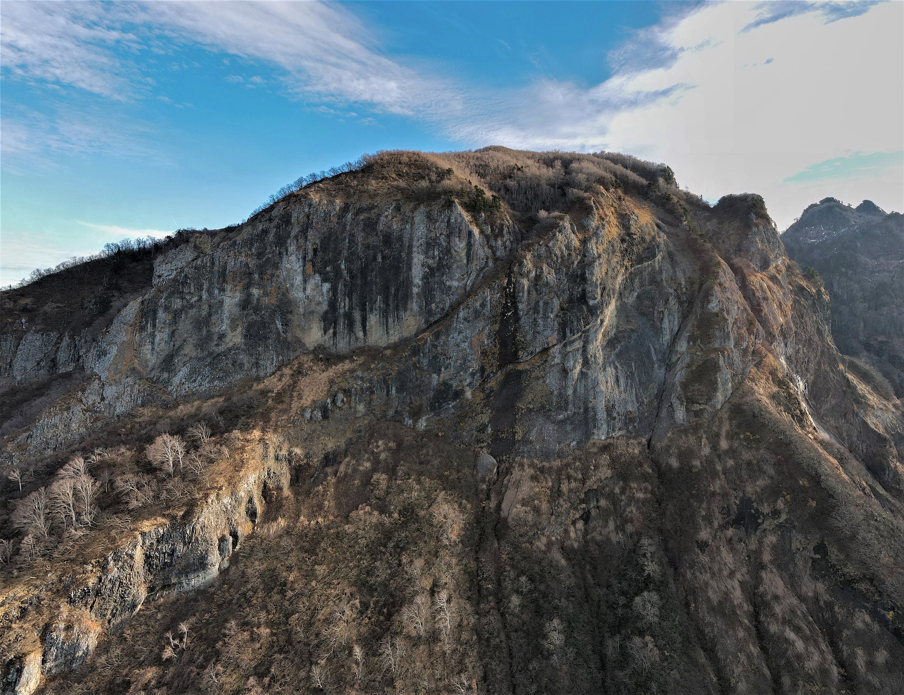
At a height of 1487m, impressive Mt. Komagatake was formed as a result of submarine volcanic eruptions. As part of the Umidani Mountains, the ridge from its peak passes over Mt. Onigatsurayama and Mt. Nokogiridake, finally ending with beautiful Mt. Amakazariyama.
A trail climbing Mt. Komagatake begins at Umidani Sankyo Park.
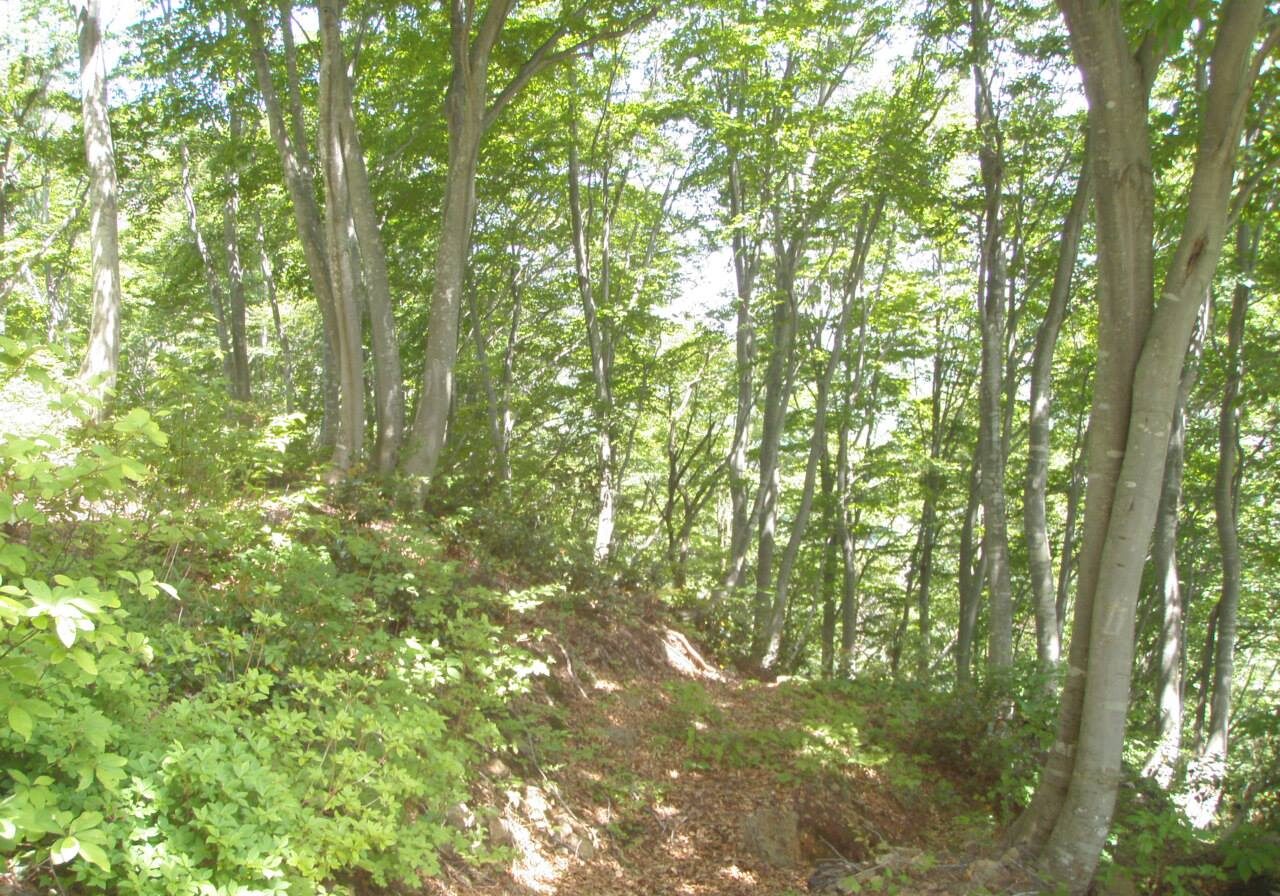
Hiking in Umidani Gorge
A swath of beech trees cuts across the base of Mt. Komagatake. These trees and the soil they live in form a sort of green dam which allows water to collect throughout this region, nourishing the plants and animals which call the Umidani Gorge home and providing exquisite hiking scenery for those who make the trek.
Kurikoshi Basket Ferry
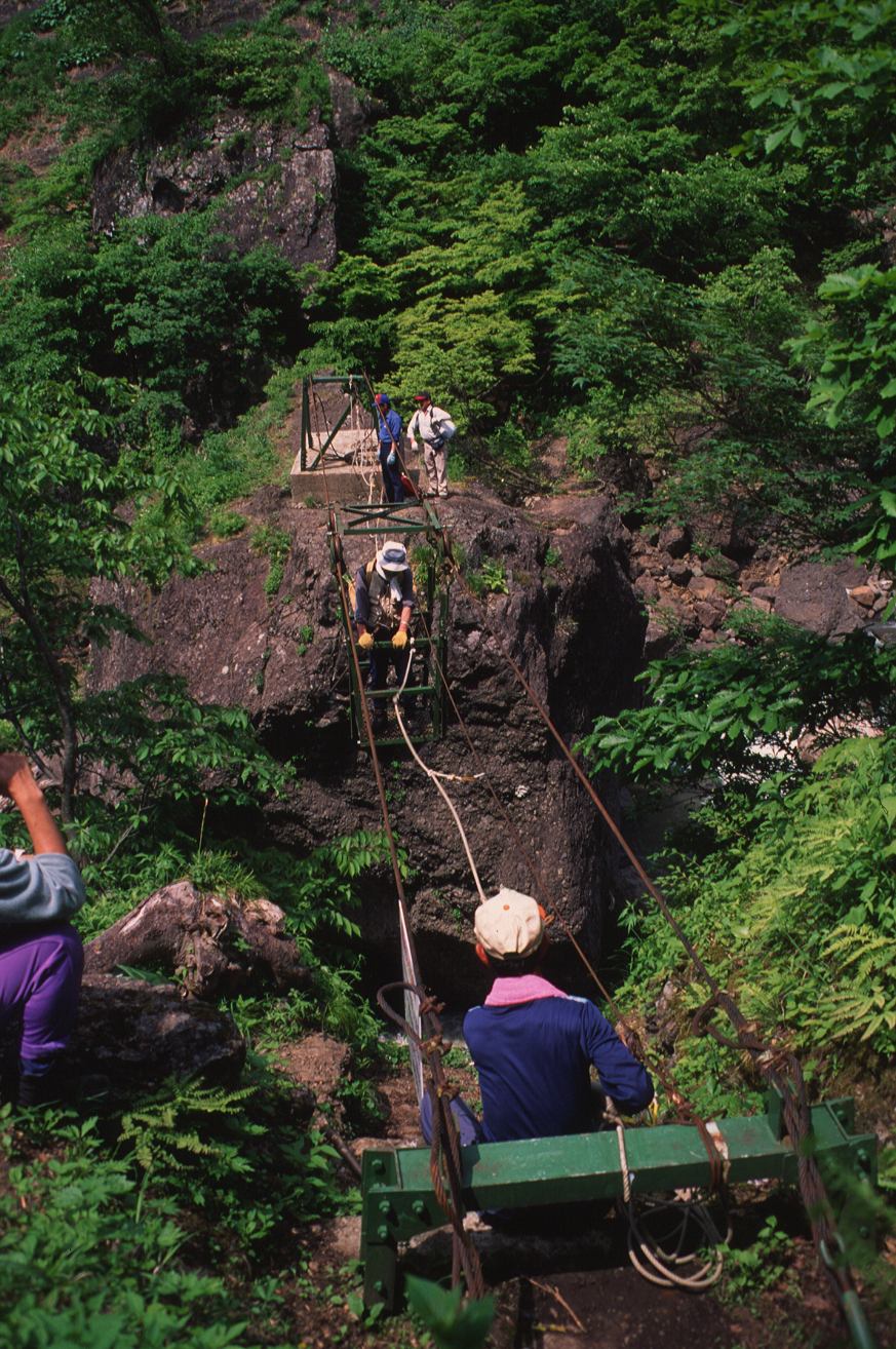
Along the trail to the Umidani Highlands is Kurikoshi, the name given to the point where the trail crosses the Umikawa River. There used to be a kago-watashi or basket bridge here. Hikers would climb into a basket supported by ropes and pulleys and pull themselves across. Such kago-watashi were once fairly common in remote mountain regions of Japan.
Unfortunately, the kago-watashi was destroyed in a flood in 1995, so now the river must be waded across on foot.
Area Access & Closures
No site access alerts

