Itoigawa-Shizuoka Tectonic Line and Salt Trail (South) Area
An Ancient Trail Along a Gigantic Fault
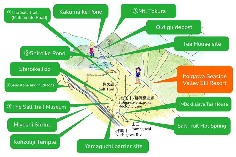
Along the Salt Trail are a number of sights, including the Sugi-no-To Great Cedar, Shiroike Pond, and the Salt Trail Museum. After visiting these, the Shionomichi Onsen Hot Spring is waiting for to wash away your sweat and fatigue.
Dividing the Japanese Islands in twain, the Itoigawa-Shizuoka Tectonic Line forms the western border of the Fossa Magna. This fault mostly follows the Himekawa River, but the section between Nechi and Kita-Otari (in Nagano Prefecture) travels through the mountains to the east. Through landslides and other geological processes, the area around the fault line formed into a gentle depression cutting through the mountains.
The Salt Trail runs along this fault, through these lowlands, avoiding the steep slopes of the mountains and the dangerous terrain and swift currents of the Himekawa River. This trail was used during from ancient times as a trade route between Niigata Prefecture (then called Echigo Province) with Nagano Prefecture (then called Shinano Province). From Echigo, fish, seaweed, and products traded by sea routes were carried inland to Shinano which in return sent tobacco, grains, and similar products. The most important product carried along this route, though, was salt, harvested along the coast, sea salt was carried inland for processing and distribution. In the days before refrigerated storage, salt was essential for the preservation of food and so the Salt Trail was like a lifeline for the people of the inland provinces. It is this reason why, even during times of civil war and bitter fighting between the provinces, this trade route was never closed or blockaded.
Enjoy walking this gently sloping forest trail. The leaves underfoot provide a soft, comfortable surface to walk upon, while the trees overhead shelter travelers from the wind, rain, and snow. Observe the scenic rural landscape along the trail and encounter a variety of wildlife, including a number of endangered species of dragonflies. Taste a bit of local culture at the Bokkajaya Tea House. And relax in the hot spring baths at Shionomichi Onsen.
1The Salt Trail(Matsumoto Road)
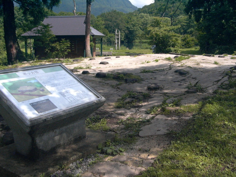
Remains of an inn along the Salt Trail
The Salt Trail formed along the natural depressions that run along the Itoigawa-Shizuoka Tectonic Line. The road was cut through to connect these depressions, creating a gentle, easily navigated route between Itoigawa and Matsumoto. Long ago, salt and other maritime products were carried along this road to what is now Nagano Prefecture by oxen or on the back of workers called bokka. Sections of the route remain well-preserved and the former sites of customs gates and inns can be seen along the trail.
2Shiroike Pond
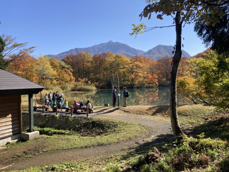
This pond is thought to have been formed by landslides along the fault line. Melting snow and clay cause the pond to sometimes turn white, giving its name which means “White Pond.” Since the Edo period it has been used as a natural reservoir for rice fields.
3Mt. Tokura
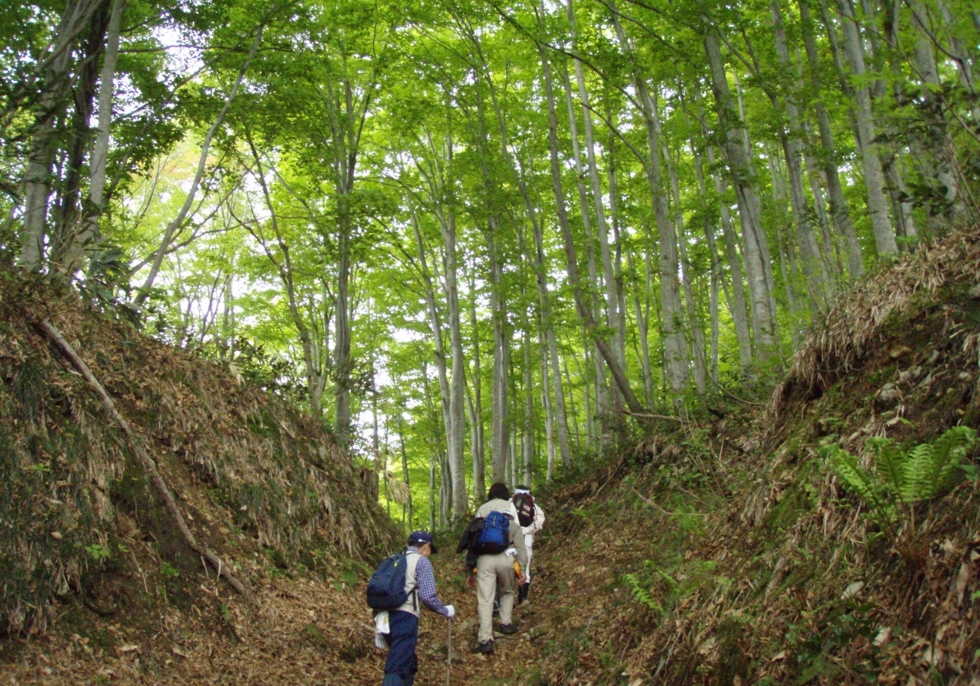
Mt. Tokurayama Climbing Trail
While at 976m it is a fairly small mountain, the view from the peak of Mt. Tokurayama is not to be missed, offering a 360 degree panorama of nearby Mt. Amakazariyama, the Northern Alps, and the Sea of Japan. On clear days you can even see as far as Noto Peninsula or Sado Island!
The trail up the mountain is well maintained and passes through a beautiful beech forest, well-protected from the elements. From Shiroike Pond it is only about 70 minutes to the peak, making it a perfect climb for beginners , but the view from the top makes it worthwhile even for the expert climber.
4Interbeds of Sandstone and Mudstone
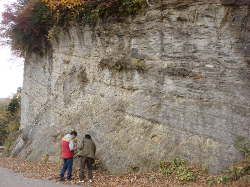
The geological strata in this area were formed underneath a sea about 10 million years ago. Alternating layers of sand and mud deposited upon the seabed eventually solidified into stone, forming the beautifully striated cliffsides visible today. Along these cliffs you can also see a fault lines as well as lava and magma formations, all examples of the geological processes that formed this region.
5The Salt Trail Museum
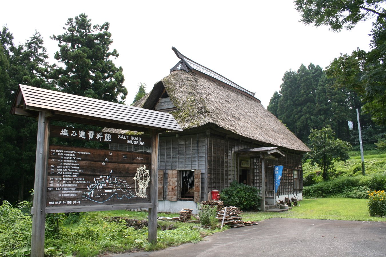
The Salt Trail was traveled on foot by porters called bokka and ox-drivers called ushikata. This small museum in a repurposed farmhouse exhibits a large collection of their tools and clothing. 706 of these items are registered as National Cultural Properties.
6Bokkajaya Tea House & Shio-no-Michi Hot Spring
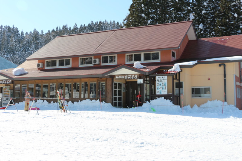
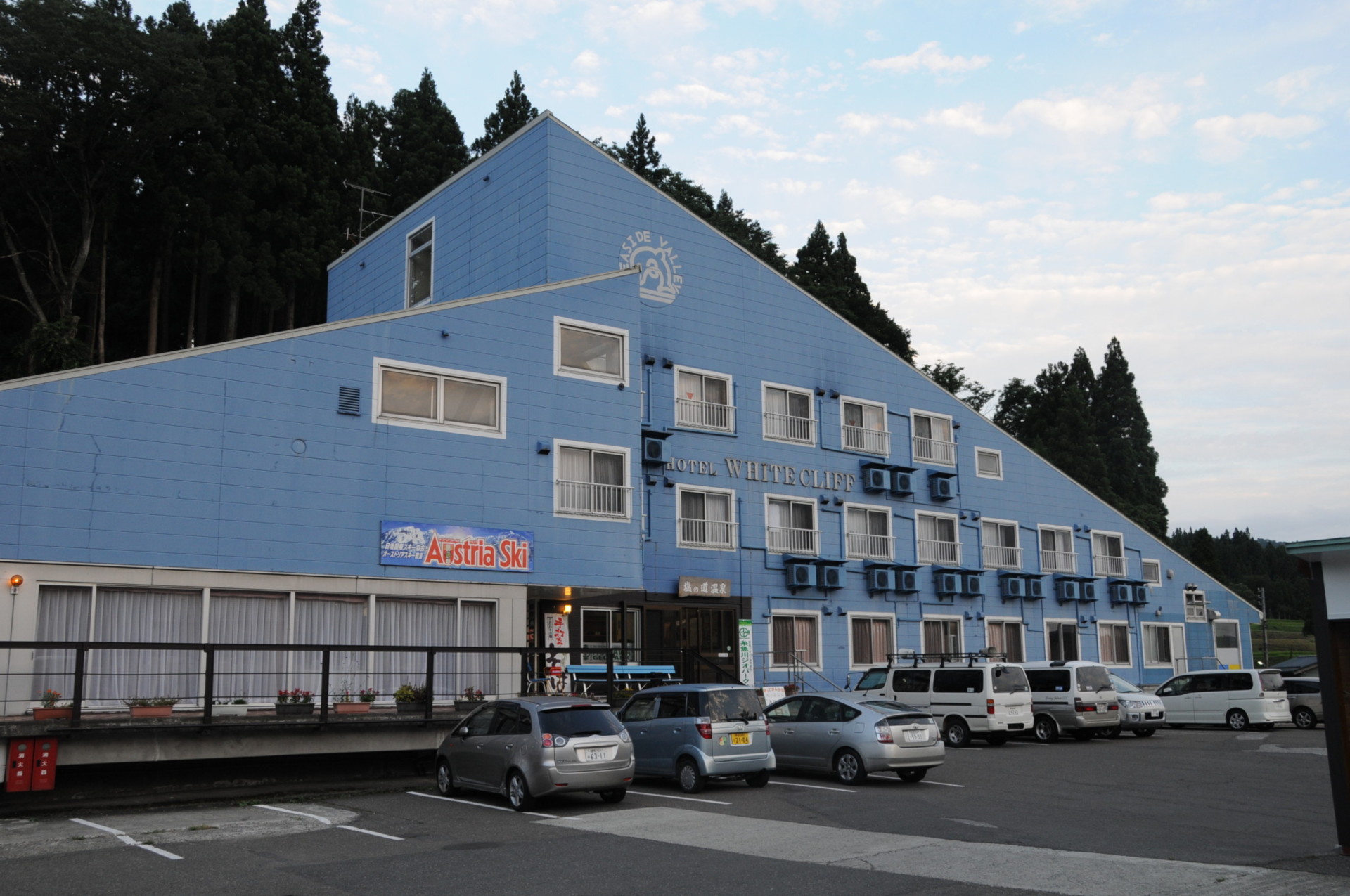
Bokkajaya is a restaurant and information center that acts as the base for visitors to the Salt Trail and Mt. Tokura. Enjoy local cuisine and handmade sobanoodles or take a relaxing soak in the restorative waters of the Shio-no-Michi Hot Spring, a natural onsen bath.
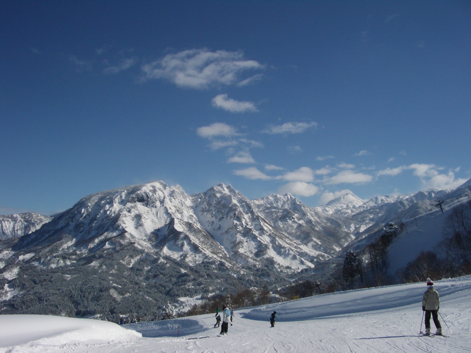
Itoigawa's Seaside Valley Ski Resort offers 6 slopes and a number of courses for skiers of all experience levels. Enjoy views of Mt. Amakzariyama, the Northern Alps, and the Sea of Japan while racing down the white slopes of the Kubiki Mountains.
7Seaside Valley Ski Resort
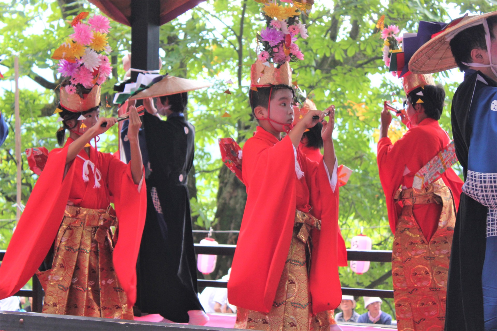
The only surviving En'nen performance in Niigata Prefecture, the origins of this ancient festival and its unusual, elegant dances performed by local children are steeped in mystery.
8Yamadera En'nen(Otetekomai Festival)
Area Access & Closures
【Prefectural Road 221】Closed

Friend Area Special
toigawa Seaside Valley Ski Area
Bokkajaya Restaurant
Salt Trail Hot Springs - Hotel White Cliff


