Oyashirazu Area
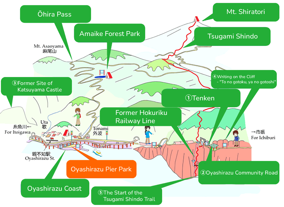
A Cliff Becomes a Highway
The cliffs at which the Northern Japanese Alps fall into the Sea of Japan were the product of terrestrial volcanic activity occurring about 100 million years ago. The ancient Hokuriku Road was wedged in a small space between these cliffs and the sea, making for a perilous journey, especially when the waves would surge. Large pockets and caves eroded into the wall where travelers would take refuge from the stormy seas still remain on the face of these cliffs.
During the Heian period (CE 794-1185), following their clan's defeat in the Genpei War, the wife of Taira no Yorimori followed her husband from Kyoto through these cliffs to the Kanbara District of Echigo Province, in what is now Nagaoka City. It was during this journey when her child was swept away by the raging waves. In memory of this, she composed the poem: "Oyashirazu ko wa kono ura no namimakura Koshiji no iso no awa to kieyuku" From this poem was born the name of these cliffs, Oyashirazu, 'without the parents knowing.'
During the Meiji era, a road was carved out halfway up the cliffs. During the Showa era a tunnel was built through the mountains, forever changing the shape of the Hokuriku Road. Finally, during the Heisei era, the fourth generation Hokuriku Expressway was completed. In addition to these four generations of roads, Oyashirazu also marks the origin of the Tsugami Shindo Road, making this the intersection of many roads from many ages. Here, where the sheer cliffs spread out against the Sea of Japan, gaze upon the many incarnations of the Hokuriku Road and enjoy a stroll along the shore where you just might find some jade!
1Tenken Oyashirazu Cliffs
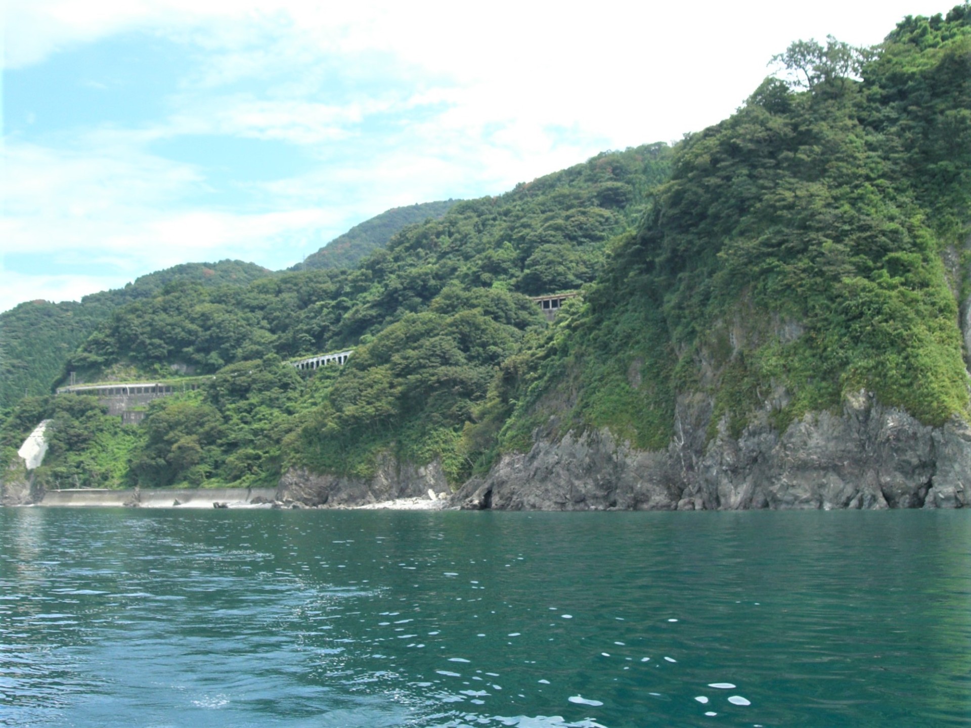
Cliffs at Oyashirazu Coast
“Parent unaware / Along this shore a child / Sleeps beside the waves / And on the Koshiji Road / Vanishes into the foam”
In the 12th century, a defeated general fled to this area. His wife followed after him, but while crossing under the cliffs, a storm swept their child out to sea and she was unable to retrieve the child above their sorrow, giving the name “Oyashirazu” which means “Parent-Doesn’t-Know.”
2Oyashirazu Community Road
The Oyashirazu Community Road was from 1883 until 1966 a national highway and the main thoroughfare carrying road traffic across Oyashirazu. It has since been repurposed as a recreational walkway.
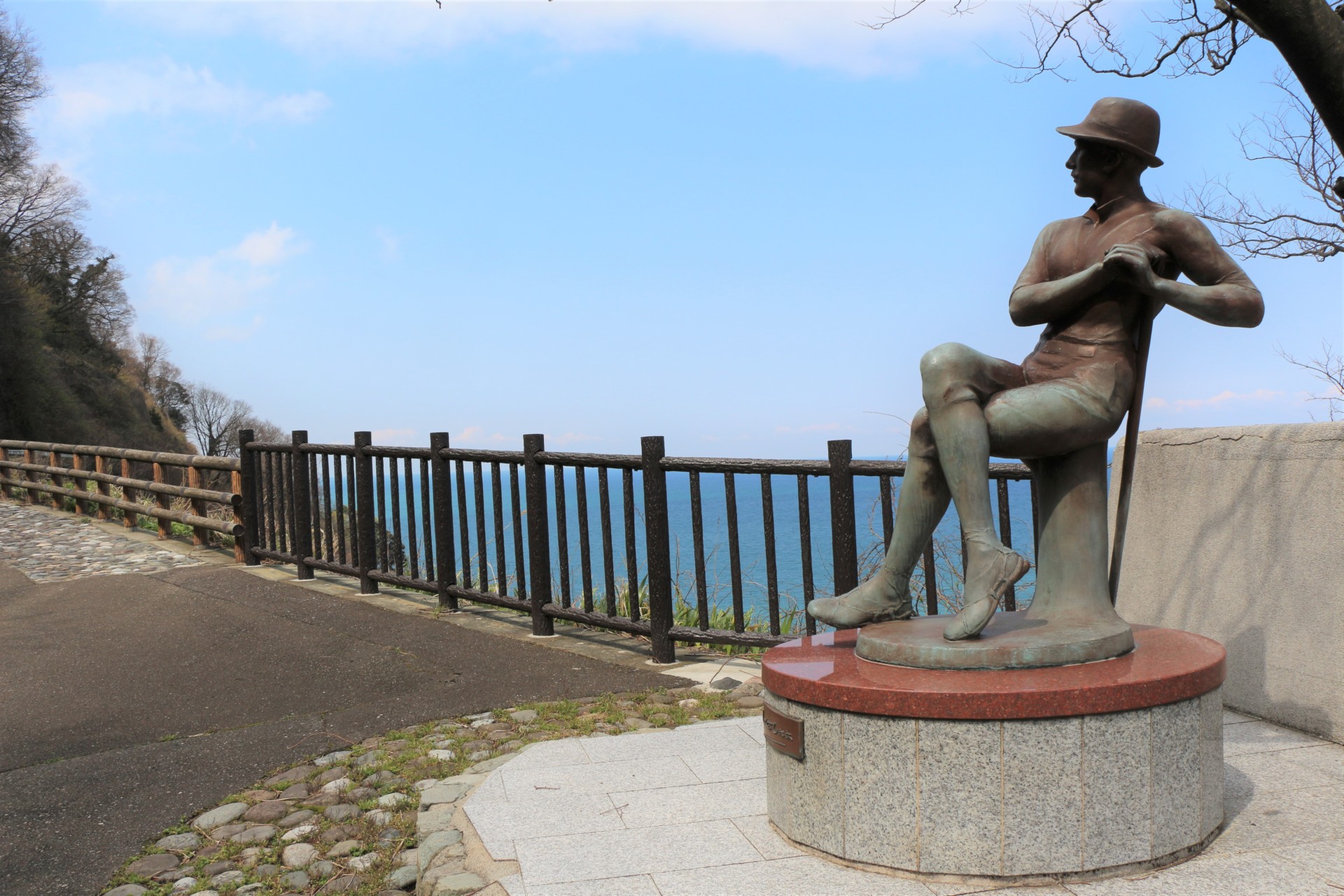
At the entrance is a small pavilion where you can see a scale model of the cliffs and a statue of Rev. Walter Weston, an English clergyman who is often considered the Father of Japanese Mountaineering. From this pavilion you can see the Sea of Japan, the cliffs of Oyashirazu, and all four generations of roads that have crossed this area, from the old Hokuriku Road below along the coast, to the modern Hokuriku Expressway curving out over the sea.
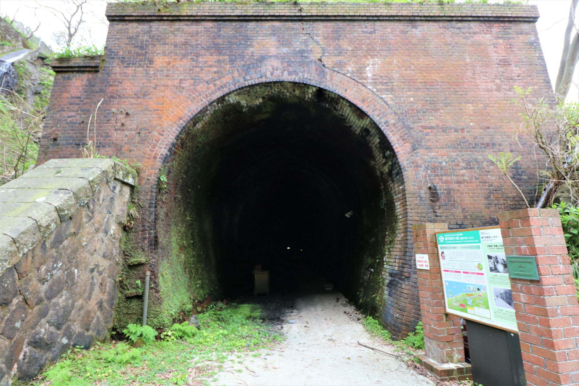
Old Oyashirazu Brick Tunnel
This tunnel was completed in 1912 as part of the old Japan National Railway Hokuriku Main Line. Some of the bricks which line the interior walls were made locally. The tunnel is equipped with lights and interpretive panels and is now open to visitors along with the Community Road above. This tunnel is designated as a National Civil Engineering Heritage Site.
3Former Site of Katsuyama Castle
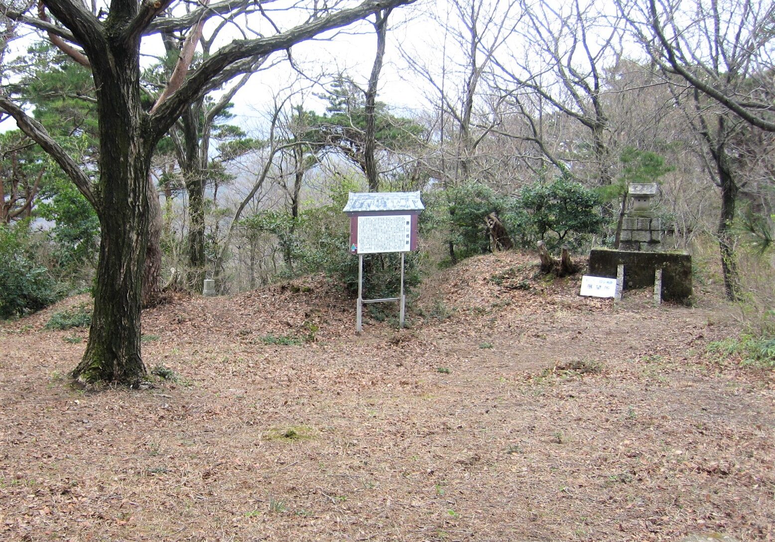
Atop this 328 m high mountain once stood a castle built by Uesugi Kagekatsu to watch over the Old Hokuriku Road below and the Sea of Japan. During the Sengoku Period, signal fires were used to communicate with other castles in the area. Legend says that Uesugi Kagekatsu and Toyotomi Hideyoshi planned their alliance here in 1585.
4Writing on the Cliff - "To no gotoku, ya no gotoshi"
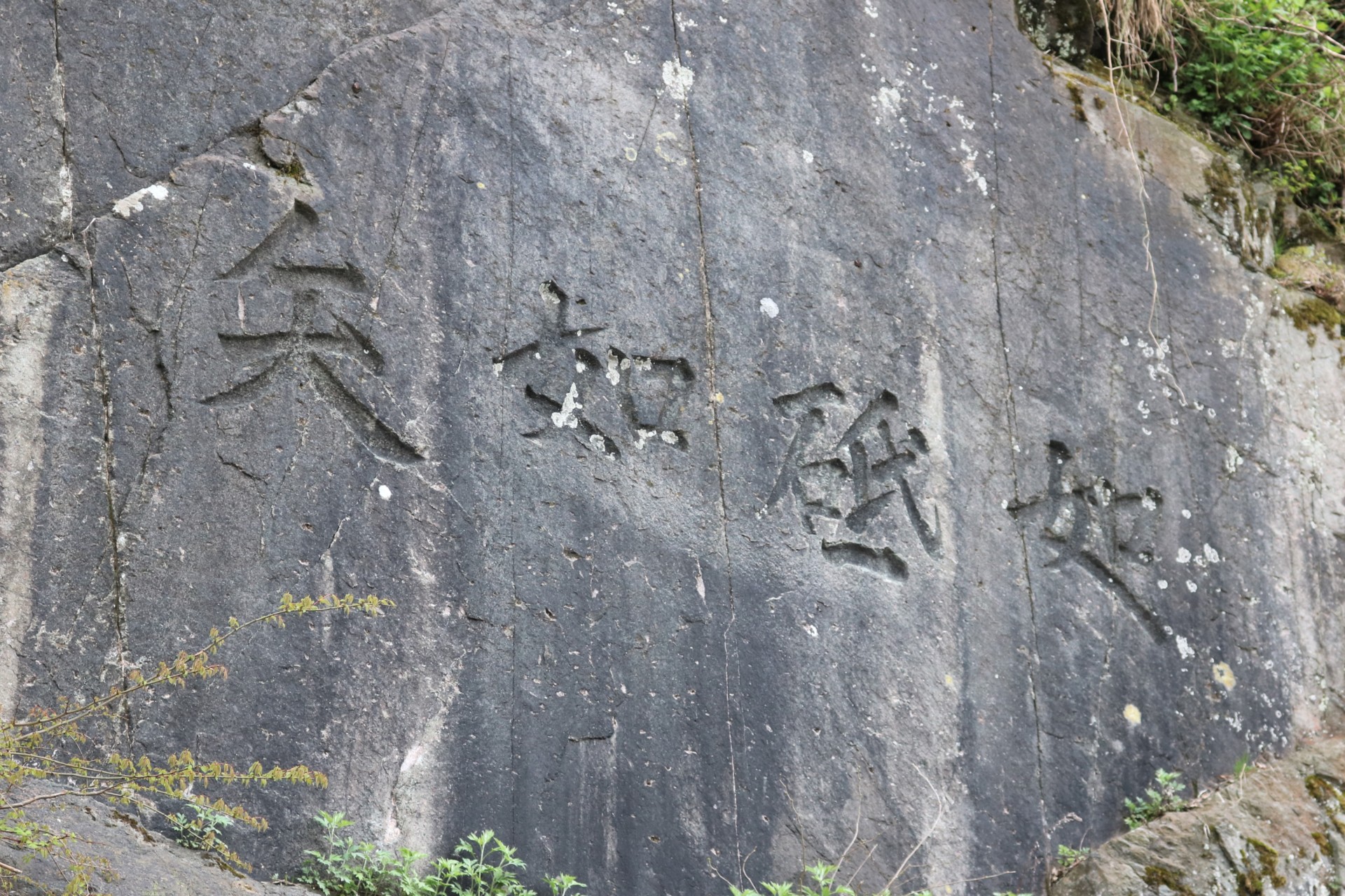
To no gotoku, ya no gotoshi
To commemorate the completion of the road in 1883, these characters were carved on the cliff face, reading "To no gotoku, ya no gotoshi."
"As smooth as a whetstone and as straight as an arrow," these words convey to us the sense of pride and accomplishment felt by the workers and engineers who had at long last bested this perilous cliff.
5The Start of the Tsugami Shindo Trail
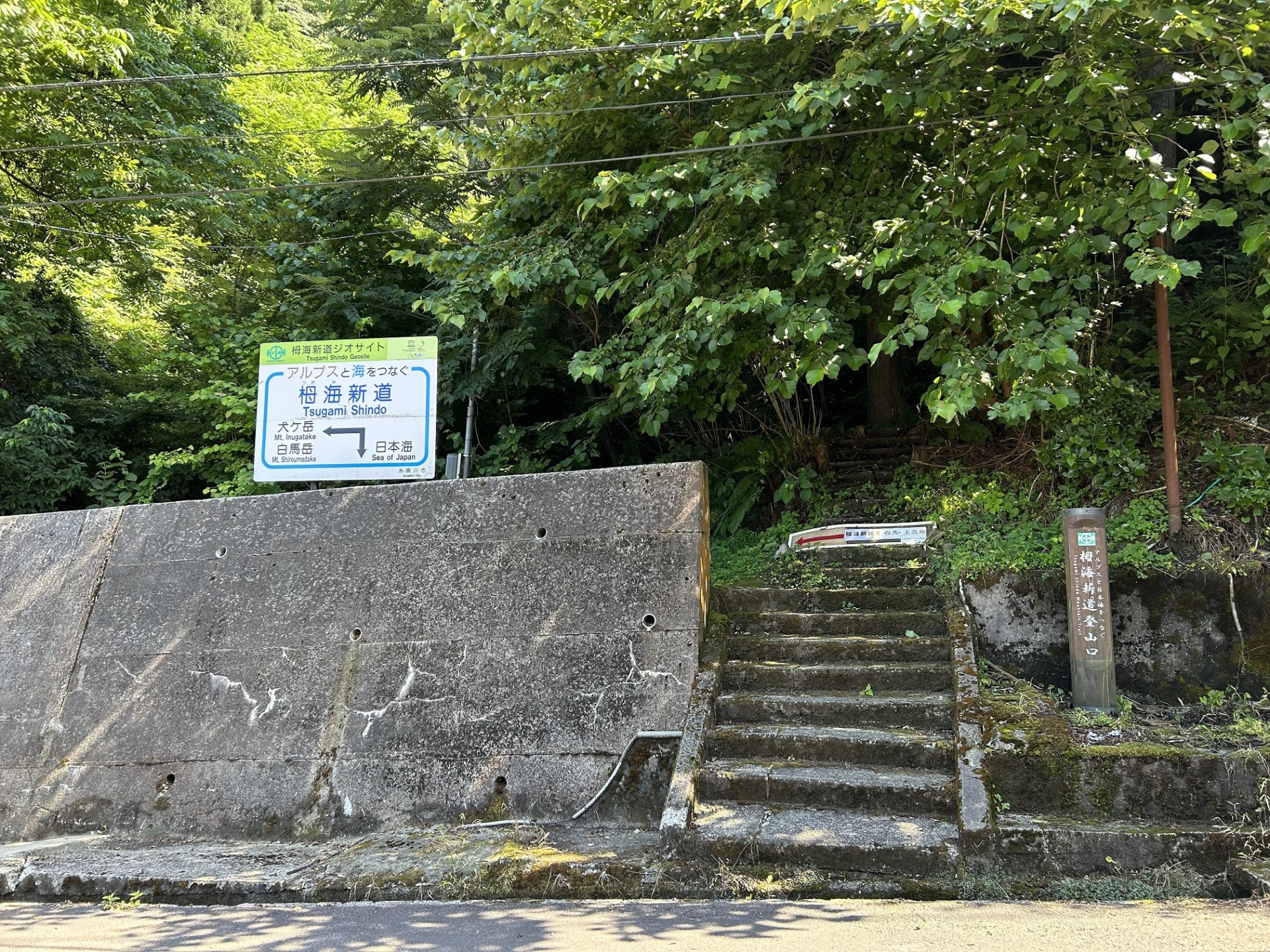
The Tsugami Shindo Trail is a unique mountain trail which connects the 3000-meter-high peaks of the Northern Alps with the Sea of Japan.
Constructed over a 10 year period starting in the 1960s, the trail starts near Oyashirazu Community Road at an elevation of 0m and ends at the peak of Mt. Asahidake at an elevation of 2418m. Here it connects with other mountain trails, offering access to higher peaks further inland.
Featuring a variety of elevations and topographical features, the trail is host to a variety of plants and wildlife, including many types of alpine flora.
6Oyashirazu Pier Park
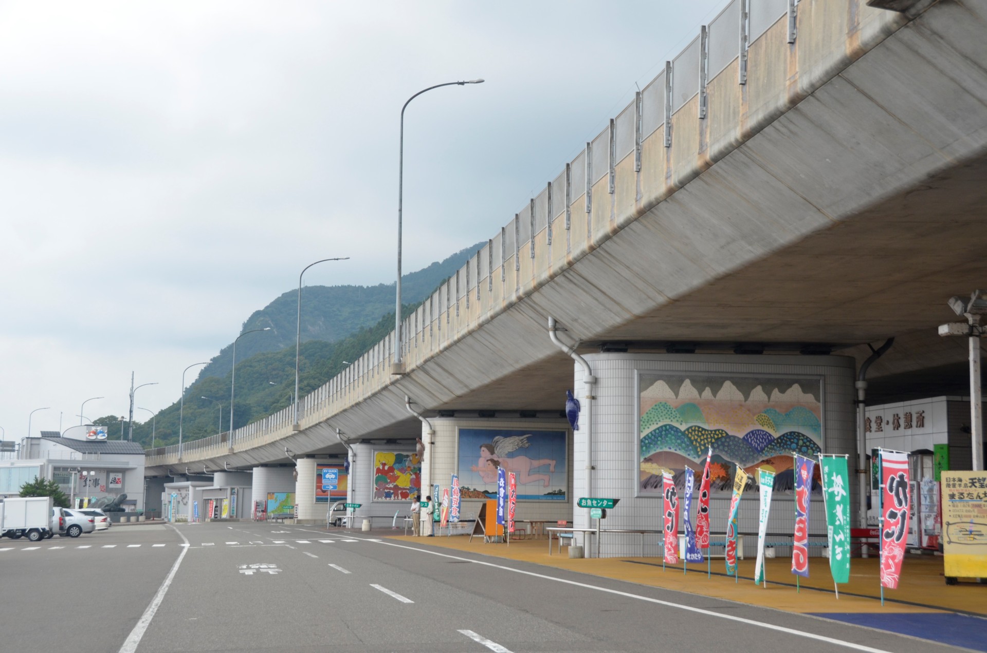
The Oyashirazu Pier Park is a Road Station, part of a network of roadside service areas and tourism facilities found along Japan's national highway system. The Pier Park opened in July 1988 to commemorate the completion of the Hokuriku Expressway, underneath which the Pier Park is uniquely located.
The Pier Park, features a beach, museum, restaurants, fish market, gift shop, and other amenities, including a bronze statue and murals designed by acclaimed artist Kiyoshi Awazu.
Area Access & Closures
Facility tours and public transportation (expressways, railways, etc.) may be affected by heavy rain, strong winds, and other weather conditions.
■Note about Oyashirazu Road Closures:
If continuous rainfall exceeds the regulatory limit, the section of National Route 8 through Oyashirazu will be completely closed to traffic due to the danger of landslides. For the latest information, please visit the website of the Takada Office of River and National Highway, Hokuriku Regional Development Bureau, Ministry of Land, Infrastructure, Transport and Tourism. Even if continuous rainfall drops to 0 mm, the road closure will remain in effect until safety can be confirmed.

