- Mt. Shirouma - Renge Hot Springs Lodge

Road & Geosite Conditions
Fully Accessible

- Number
- Area
- 1. Ichiburi Geosite
- 2. Oyashirazu Geosite
- 3. Omi Coast Geosite
- 4. Omigawa Jade Gorge Geosite
- 5. Imai Geosite
- 6. Itoigawa-Shizuoka Tectonic Line and Salt Trail(North) Geosite
- 7. Maikomidaira Geosite
- 8. Hashidate Gold Mine Geosite
- 9. Kotakigawa Jade Gorge Geosite
- 10. Tsugami Shindo Geosite
- 11. Himekawa Gorge Via Oito Line Geosite
- 12. Itoigawa-Shizuoka Tectonic Line and Salt Trail(South) Geosite
- 13. Himekawa Gorge Geosite
- 14. Renge Geosite
- 15. Itoigawa Coast Geosite
- 16. Miyama Park and Museums Geosite
- 17. Tsukimizunoike Geosite
- 18. Umidani Gorge Geosite
- 19. Amakazariyama Geosite
- 20. Yakeyama Geosite
- 21. Benten-iwa Geosite
- 22. Shindosan Geosite
- 23. Gongendake Geosite
- 24. Tsutsuishi Hamatokuai Geosite
- Jade
- 1. Ichiburi Geosite
- 2. Oyashirazu Geosite
- 3. Omi Coast Geosite
- 4. Omigawa Jade Gorge Geosite
- 9. Kotakigawa Jade Gorge Geosite
- 15. Itoigawa Coast Geosite
- 16. Miyama Park and Museums Geosite
- Fossa Magna
- 5. Imai Geosite
- Itoigawa-Shizuoka Tectonic Line and Salt Trail(North) Geosite
- 11. Himekawa Gorge Via Oito Line Geosite
- 12. Itoigawa-Shizuoka Tectonic Line and Salt Trail(South) Geosite
- 13. Himekawa Gorge Geosite
- 17. Tsukimizunoike Geosite
- 21. Benten-iwa Geosite
- 22. Shindosan Geosite
- 24. Tsutsuishi Hamatokuai Geosite
- Mountainous areas
- 7. Maikomidaira Geosite
- 8. Hashidate Gold Mine Geosite
- 10. Tsugami Shindo
- 14. Renge Geosite
- 18. Umidani Gorge Geosite
- 19. Amakazariyama Geosite
- 20. Yakeyama Geosite
- 23. Gongendake Geosite
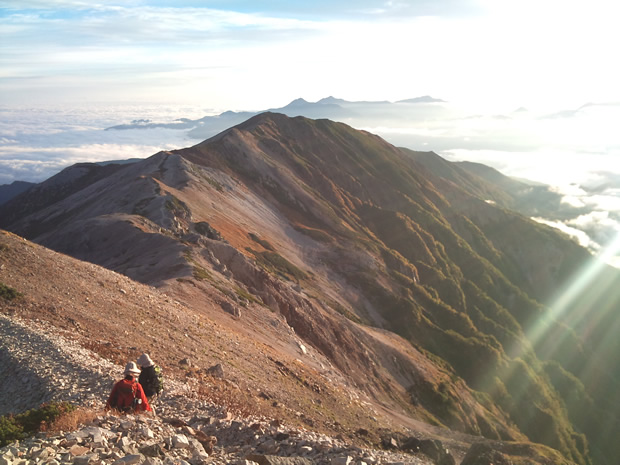
The Renge Geosite is located in the northernmost part of the Chubu Sangaku National Park. It was here in 1902 where Professor Naokata Yamasaki of Tokyo University confirmed the first example of glacial topography in the country. In the region are several examples of glacial wetlands as well as ponds. Heimanotaira Marsh, created as a result of glacial activity, features a dazzling display of alpine flowers which come into bloom starting in early summer and continuing through autumn.
Another feature of the area is the asymmetric mountain ridges formed by large-scale collapses. These collapses continue to shape the topography of the region today, even as recently as 2007, when the peak of Mt. Korenge collapsed forming a large, new ridge and causing the mountain to lose 3 meters in height. You can enjoy the beautiful, rugged landscapes formed by these collapses while relaxing in the hot spring baths of Renge Onsen, located in the middle of a region of intense fumarolic activity.
Along a mountain trail leading to the peak of nearby Mt. Shirouma, the remains of the Renge Mine's offices, smelting furnaces, and tunnel entrances can be seen. A silver and lead mine, Renge Mine operated from the 1840s until the 1920s. In 1894, Rev. Walter Weston stopped by this mine while climbing the trail up Mt. Shirouma. Rev. Weston noted in his travel journals that the miners there asked him questions about the quality of the minerals in the area.
 Heimanotaira Wetlands
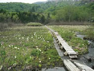
Located just west of Renge Onsen Hot Springs, this marshland becomes awash with color from early summer through autumn when its many native alpine plants come into bloom.
Sand and debris intrusion from the surrounding mountains threaten this marsh, which is becoming smaller and shallower over time.
 Renge Onsen Outdoor Hot Springs

Renge Onsen Lodge boasts five different baths: one indoor and four outdoor. However, unlike many other hot springs baths, these outdoor baths are truly outdoor, without walls or barriers of any kind.
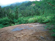
About 15 minutes from the lodge, the hiking trail enters a fumarolic field in which steam billows from the earth. Scattered about here are four baths, roughly at a height of 1550 meters, offering an unparalleled experience as you bathe not only in hot spring water, but in the majesty of the Northern Alps.
The baths here are mixed bathing. Please pay at the lodge before entering.
 Shiraike Pond
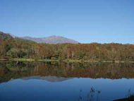
This pond, located at an elevation of about 1,090 meters, was formed as the result of lava flow from nearby Hakuba-oike Volcano. It is about 450 by 250 meters in size, roughly oval-shaped with a depth of less than 5 meters. The reflection of autumn foliage and the distant mountains makes this pond extremely beautiful on clear days.
 Former Site of Renge Mine
Along the trail which leads to the peak of Mt. Shiroumadake are the sites of several remains of Renge Mine which mined silver and lead in this area from the late 1800s until the 1920s. In 1894, Rev. Walter Weston visited this mine while he was climbing Mt. Shiroumadake.
Renge Nature Trail
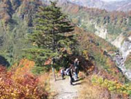
The Renge Nature Trail circles around Heima-no-taira Marsh and includes many sections of boardwalk. It is a very long course if completely walked, so light hiking equipment is recommended.
Renge Onsen Lodge
Renge Onsen Lodge is the facility which maintains and operates the Renge Onsen Hot Springs. The lodge contains a number of rooms available for rent as well as showers and a cafeteria, making it a popular spot for hikers and other outdoors enthusiasts. In winter, even though the road closes to automobile traffic, the area around the lodge becomes a backcountry skiers paradise for those willing to make the trek.
Due to limited space, guests often have to share rooms during particularly busy periods, contributing to the cozy, mountaintop atmosphere of the lodge.


